The PeatPic Project
2025 Nobel Peat Prize for Best Peatland Paper (International) nominee
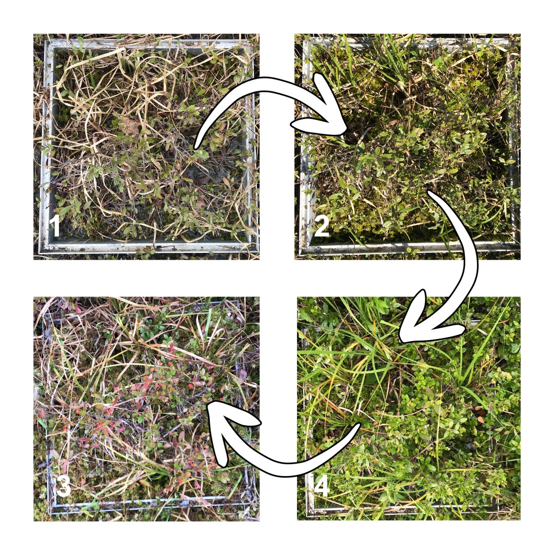
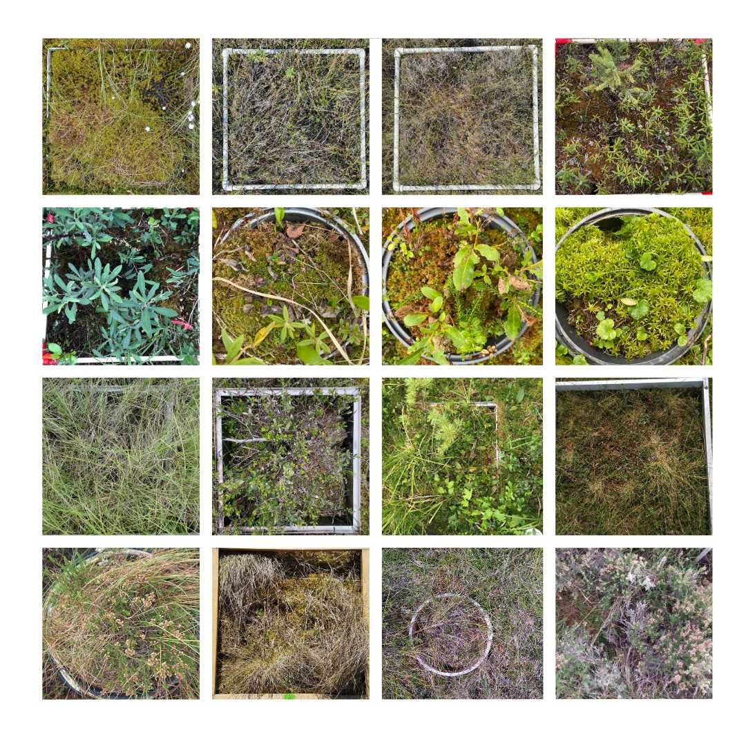
The PeatPic Project is an international community-science project that uses smartphone photos to track how peatlands change through the seasons. By collecting thousands of images from peatlands around the world, the project revealed clear differences in plant growth timing between bogs, fens, and swamps.
This low-cost approach helps scientists better understand peatland health and improve predictions of how these vital carbon-storing ecosystems may respond to climate change.
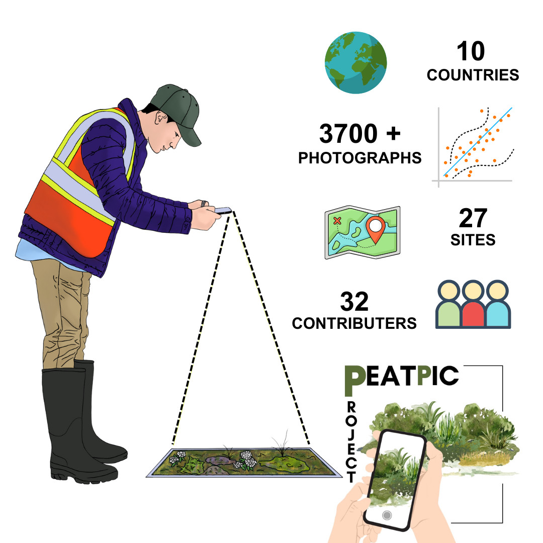
The results of our study showed that peatlands do not all behave the same way through the year. Using more than 3,700 photographs collected from 27 sites across 10 countries, the project found strong differences in the timing of plant growth between peatland types and vegetation communities.
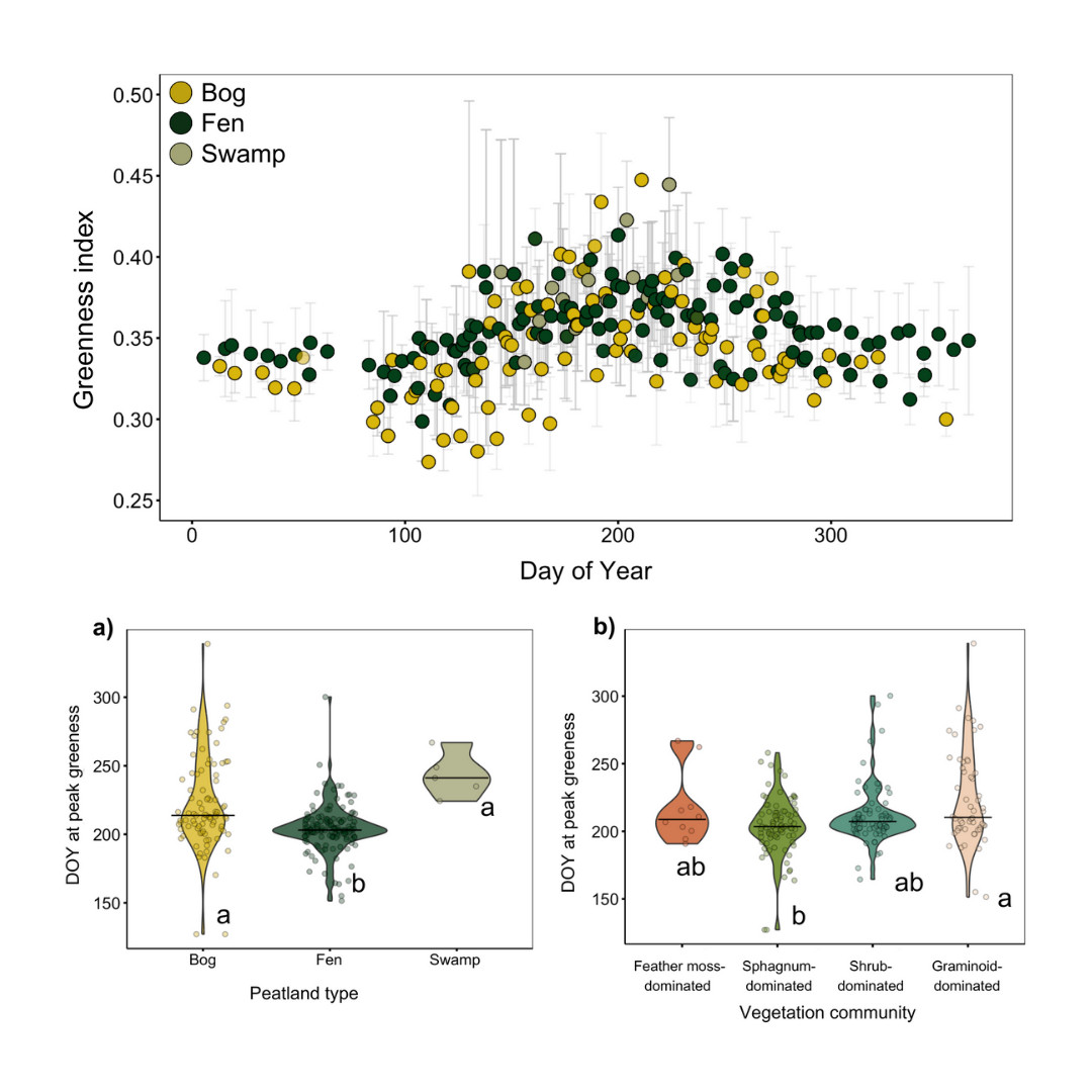
Bogs reached peak greenness around 10 days later than fens, and these seasonal patterns were closely linked to vegetation type and local energy conditions, highlighting the importance of small-scale differences in how peatlands function and store carbon.
The PeatPic Project data are openly available and can be accessed via the Dryad data repository here: The PeatPic project: Predicting plot-scale green leaf phenology across peatlands
You can read the open-access paper here:
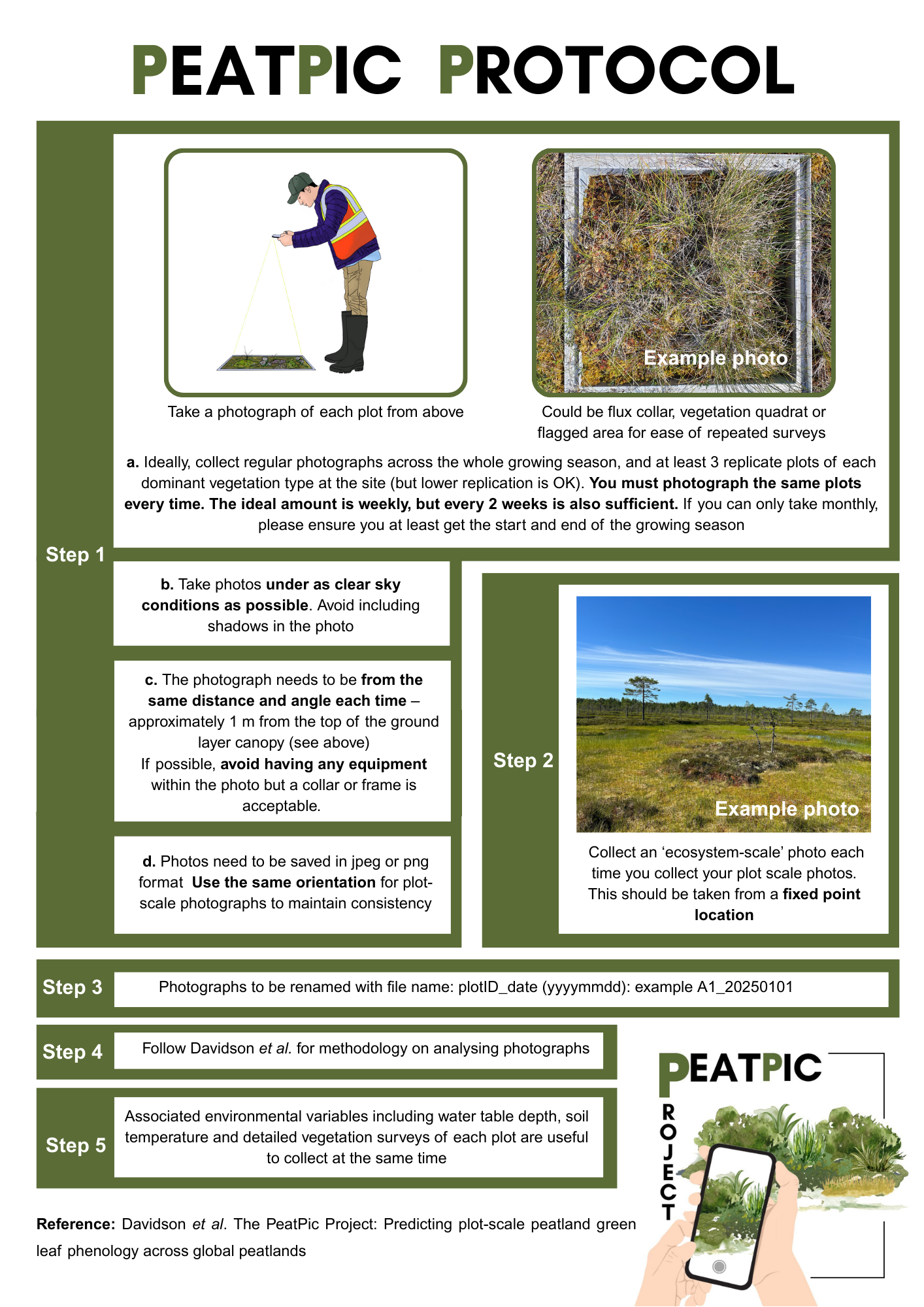
You can follow the protocol below if you would like to collect similar data at your own sites: